
Land bank management: every khasra of every lease, on one map
Minocular Land Bank Management puts the lease cadastral map on satellite imagery and keeps one record per khasra: owners and shares, valuation and payments, sale deed, mutation, possession, compensation, forest clearances and documents. The land team runs acquisition from the system, and management sees which parcels are in hand, under negotiation or stuck.
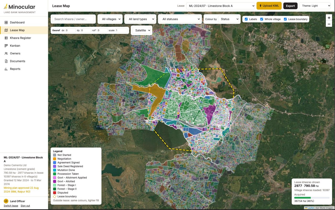
What Land Bank Management delivers
Land Bank Management is one part of the Minocular platform.
All capabilities share one equipment list, one shift calendar and one set of reports. Most mines start with one capability and add others later without a second integration.
See the whole platform →From the lease map to the khasra record
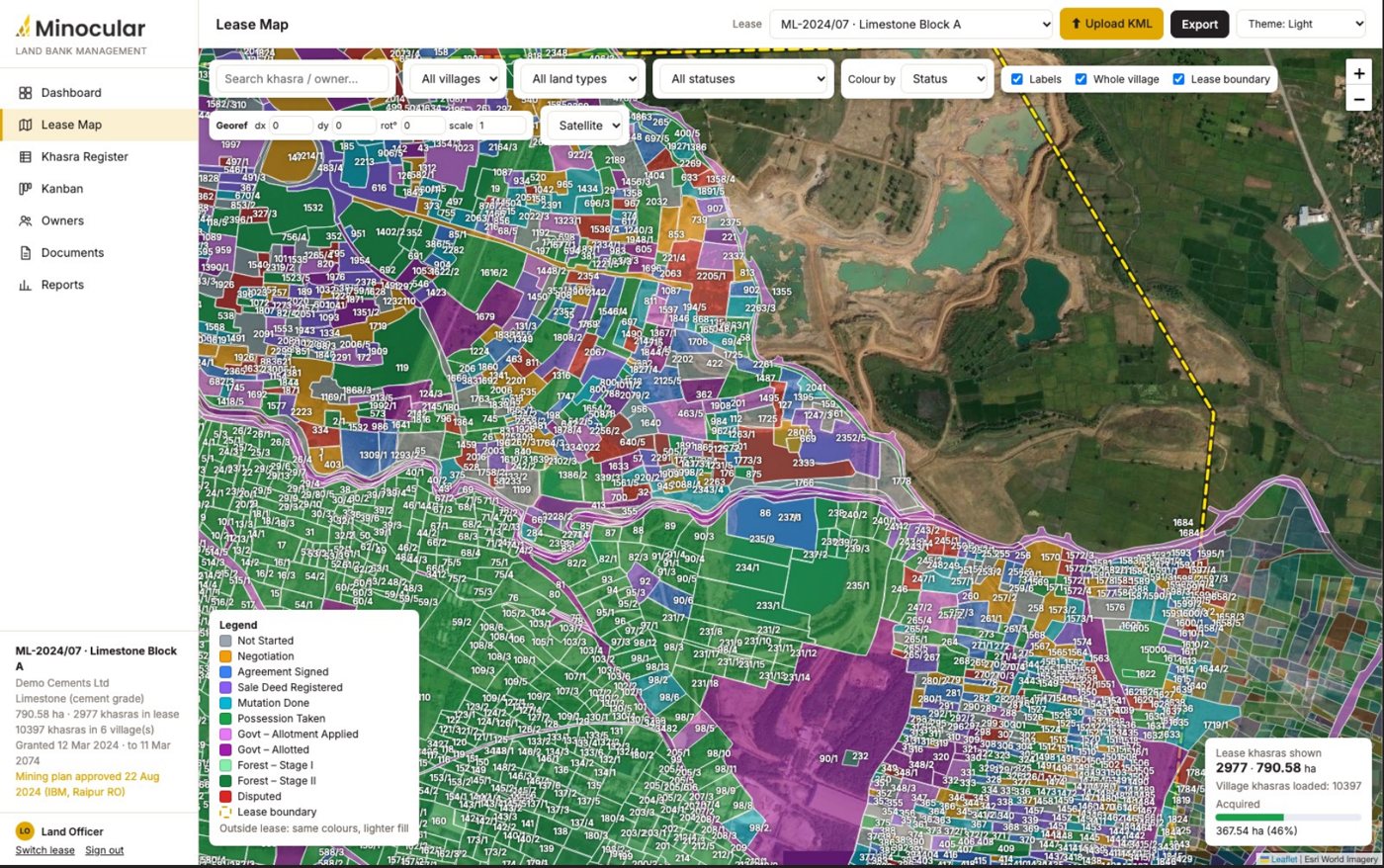
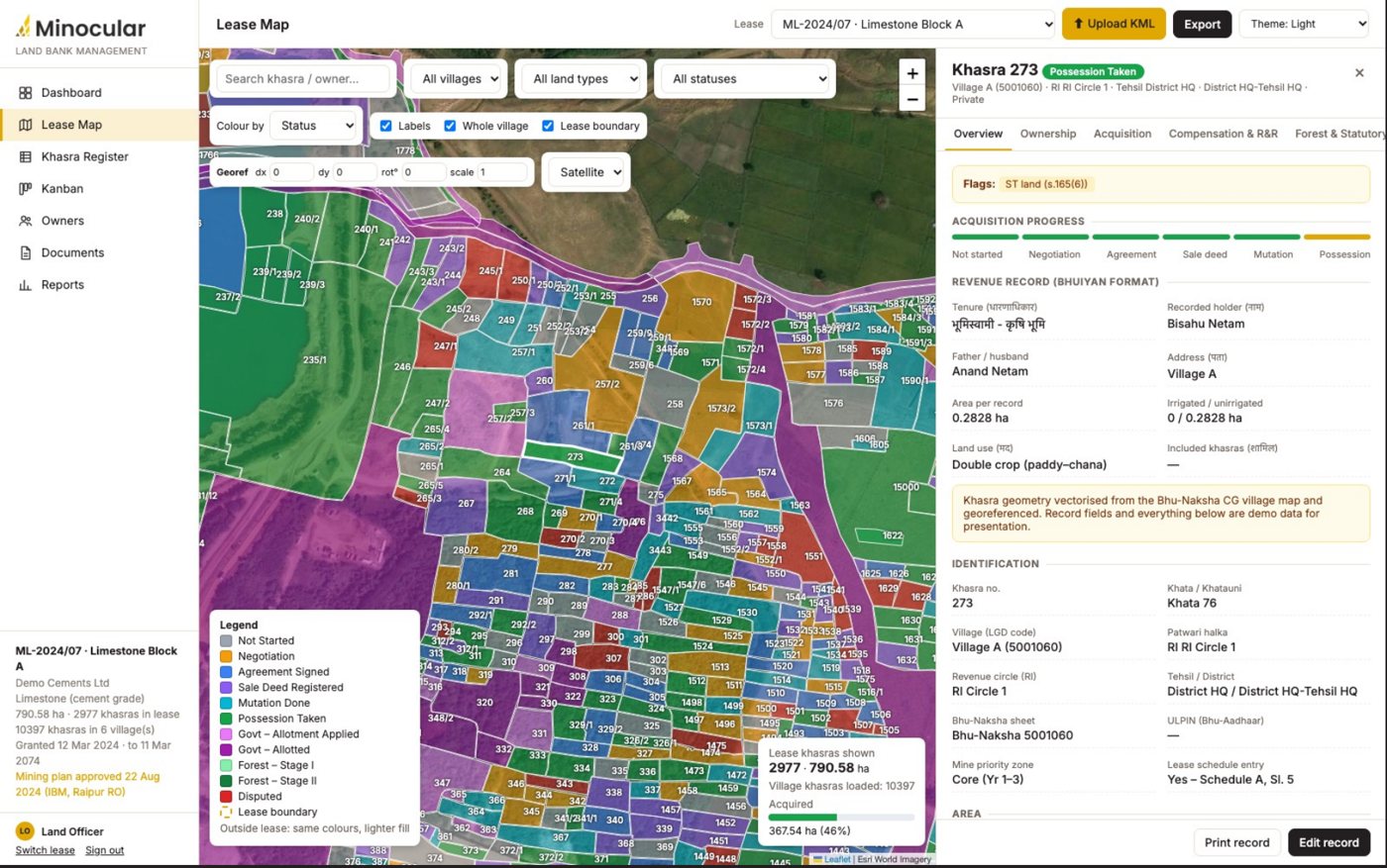
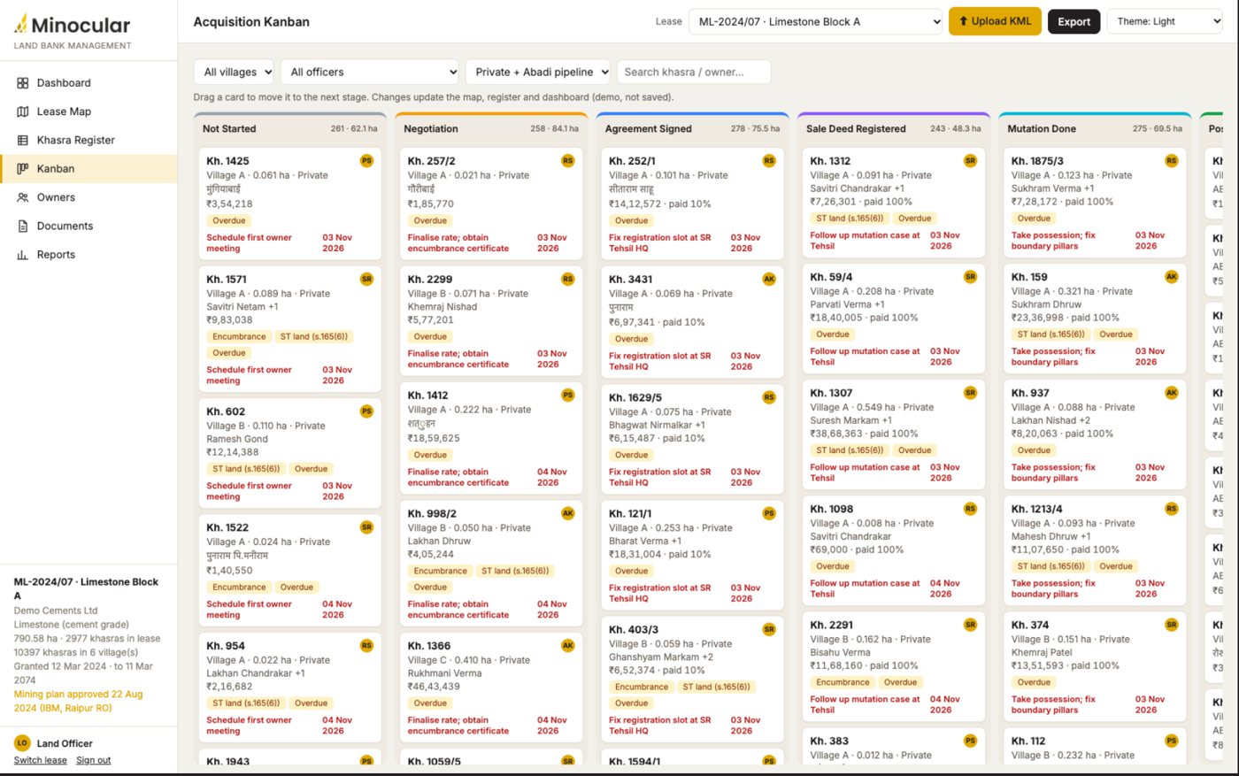
Screens from the Minocular land bank application. Owner names, areas and amounts on them are sample data.
Questions about land bank management
What is land bank management for a mine?
It is the record of every land parcel (khasra) inside and around a mining lease: who owns it, what stage acquisition is at, what has been paid, which documents are on file and which clearances are pending. Minocular keeps this on one map instead of revenue records, Excel trackers and KML files spread across teams.
Where does the khasra map come from?
From state revenue portals such as Bhu-Naksha and Bhuiyan, surveyor KML or shapefiles, DGPS boundary files or drone orthomosaics. The village maps are vectorised and aligned on satellite imagery, and a georeferencing control lets the surveyor fine-tune the overlay.
Does it handle forest and government land?
Yes. Government allotment and forest diversion run as separate tracks next to private purchase, with FCA Stage I and II, NPV, compensatory afforestation land, PARIVESH status and surface rights tracked per khasra.
Who can see owner personal data?
Access is role based: land officer, legal, finance, management and auditor. Owner personal data is access-controlled and masked, payments and status changes go through maker-checker, and every change is logged per khasra.
How long does it take to go live?
The first lease goes live in phase 1, which covers the map, the khasra register seeded from revenue records, the dashboard, the PDF record and migration of the existing Excel trackers.
Send the lease boundary and village list; we will show your land position on one map.